Uygulamalar ve sistemler
Uni-F001 · sabit kanat görevleri
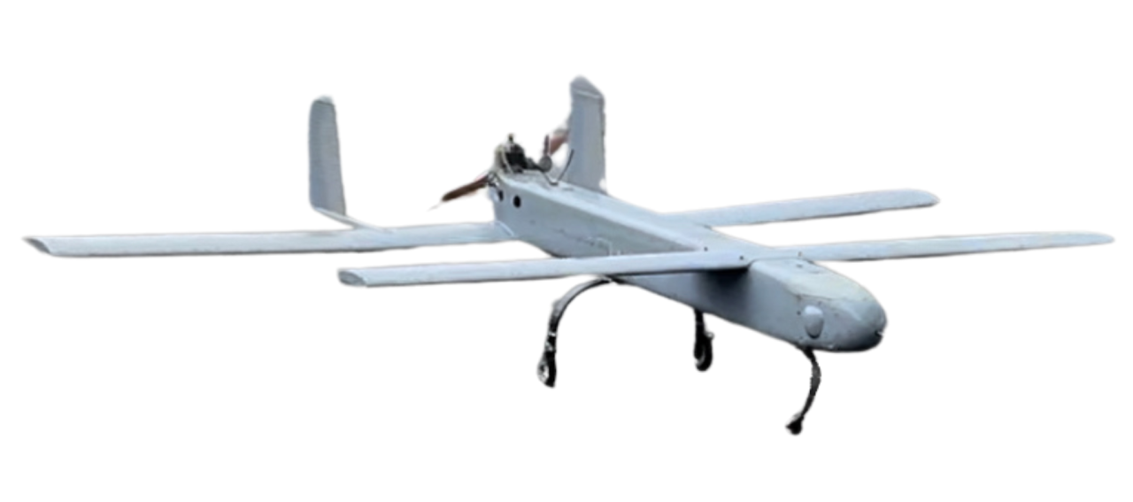
Kaynak bu benzinli sabit kanatlı uçağı uzun menzilli gözetim ve taşıma için konumlandırır. Yük, yakıt, kalkış koşulları ve iletişimi tek görev olarak tanımlayın.
Sistemi inceleyinKaynak kaydı · İngilizce / Çince orijinal · 25
Orijinal web sitesi metni kaynak dilinde aşağıdadır. Çevrilmiş girişler okuma rehberidir; kaynağın tam çevirisi değildir. Projeniz için yapılandırmayı ve çalışma koşullarını doğrulayın.
Application - Long Range Surveillance, Delivery
Fuselage Shape
Body Dimension: 240 cm (L) x 55 cm (W) x 70 cm (H)
Front Wingspan: 240 cm
Rear Wingspan: 320 cm
Body
Empty Weight: 18 kg
Material: Carbon/ Glass Fiber (Sandwich Structure)
Power source: 80c.c. gasoline engine
Fuel Tank: 5 - 15 liters
Blades: Wood (specifications need to meet the flight performance requirements of each section)
Landing Gear: Fixed
Flight Performance
Flight time (with a 40 kg load): More than 8 hours
Maximum take-off weight: 40 kg (designed)
Maximum Payload: 22 kg (fuel included)
Flight Speed
Cruising speed: 80 km per hour
Maximum Air Speed: 190 km per hour
Flight Guidance and Image Transmission Distance
Operational Ceiling: 4.5 km ASL
Operational Radius: 50 km (AP Link)
Flight guidance and image transmission distance: 20 km
Lens: Compatible with different gimbal camera types based on specific needs
Support: Ground station / Communication relay
Provided a flat-panel directional antenna which can track and point to the position of the flying vehicle
OSD screen: display altitude, speed, satellite reception status, position coordinates, voltage status, direction and distance of Home point, flight time flight distance
Automatic Flight
Provided automatic take-off and landing, waypoint setting, low voltage / power failure can be automatic return and landing, the operator can switch manual / automatic flight.
The ground station displays the information of the aircraft body in the whole process, including:
Display the take-off point, return point, real-time position of flying, direction, and scheduled route with the map.
Display altitude, speed, heading, attitude (Roll and pitch), real-time voltage status with instrument graphics.
Other display items: Flight distance, straight-line distance from take-off point, and real-time position coordinates of flying.
Flying Accuracy
Flying with the GPS system, the positioning accuracy is within 1.5 m.
Flying with the RTK system, the positioning accuracy is within 30 cm.
Project
Heavy Duty Long Duration Unmanned vTOL for MiL
Kaynak bu benzinli sabit kanatlı uçağı uzun menzilli gözetim ve taşıma için konumlandırır. Yük, yakıt, kalkış koşulları ve iletişimi tek görev olarak tanımlayın.
Sistemi inceleyinUNI-CO TECH / İhtiyaçlarınızı paylaşın
Sahayı, görevi, yükü ve çalışma kısıtlarını açıklayın. Talebiniz inceleme ve atama için platformda saklanır.
İletişim bilgileri ve ekler talebi işlemek için yetkili platform yöneticilerine açıktır. Tedarikçiye otomatik bildirim gönderilmez. Erişim veya silme talepleri için platformun gizlilik iletişimini kullanın.
Gizlilik ve talep işleme