Skip to content
合機 (Hé Jī)TAIWAN SYSTEMS INTEGRATION

PRODUCTS · APPLICATIONS · ORIGINAL EVIDENCE

Help the vehicle know where it is

Navigation combines position information with the route the vehicle should follow. RTK uses correction information to improve a satellite position estimate.

Historical original-supplier material. Current availability, configuration and responsibility are confirmed per project.

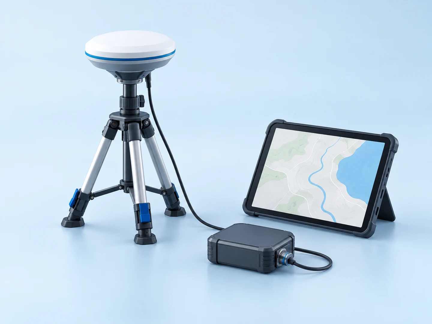
AI-generated concept illustrating Help the vehicle know where it is
AI-generated concept illustration. Original equipment photographs and documents are presented below.

COMPLETE CONTENT / ORIGINAL COMPANY RECORD

See the details.
Inspect the source.

The original text, specifications, images and media are arranged below for direct reading. Company-published claims remain attributed to their source; they are not new test results or current delivery commitments.

01 / HISTORICAL SUPPLIER SOURCE · P2

HJ-Arrow GNSS Serise

Part Number: AGP-0005

Compact, lightweight: under 30 g

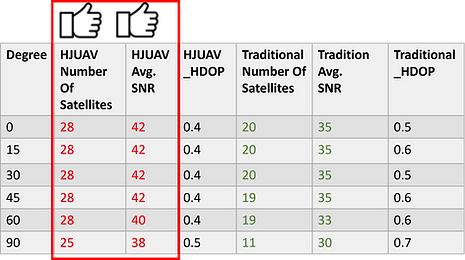
Average satellite acquisition time below 30 s

Average of more than 25 satellites acquired

Compatible with e-GNSS service

UART interface commonly used by UAVs

Supports Pixhawk flight controllers

Supports ArduPilot 4.0.0 and later

Supports 433/915 Hz telemetry equipment [unit retained as written in the source; requires confirmation]

Supports 4G LTE / 5G transmission (Drone Link)

Horizontal accuracy 7 mm; vertical accuracy 14 mm

Published figures and conditions are retained from the source. Confirm the exact configuration, test setup, date and applicable scope before using them as an acceptance requirement.
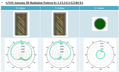
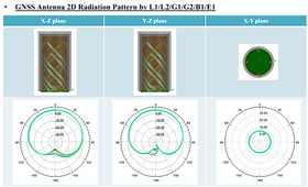
Original source image 1
Original source image 1 · Original image; click to enlarge

02 / HISTORICAL SUPPLIER SOURCE · P2

000000.png
000000.png · Original image; click to enlarge
Original source image 3
Original source image 3 · Original image; click to enlarge

03 / HISTORICAL SUPPLIER SOURCE · P2

RTK Lite scenario presentation — page 3

RTK Lite scenario presentation — page 3
RTK Lite scenario presentation — page 3 · Original image; click to enlarge

04 / HISTORICAL SUPPLIER SOURCE · P2

RTK Lite scenario presentation — page 2

RTK Lite scenario presentation — page 2
RTK Lite scenario presentation — page 2 · Original image; click to enlarge

05 / HISTORICAL SUPPLIER SOURCE · P2

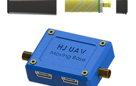
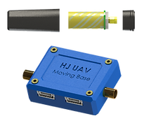
Moving Base(Lite)1 (1)

Moving Base(Lite)1 (1)
Moving Base(Lite)1 (1) · Original image; click to enlarge

06 / HISTORICAL SUPPLIER SOURCE · P2

RTK Lite scenario presentation — page 3

1/5

HJ-Arrow GNSS equipment offers the following interfaces with the National Land Surveying and Mapping Center's e-GNSS service:

1. A private base station provides UAV corrections over RF
2. The UAV connects directly to the national surveying center for corrections
3. A private base station provides corrections over a mobile network
4. A private base station uses VBS-RTK to further correct its own position

RTK-Lite receives multiple satellite constellations, including GPS, GLONASS, Galileo and BeiDou.

It can use a mobile phone or built-in SIM card to connect wirelessly to the national surveying center's e-GNSS server for high-precision real-time kinematic positioning.
The source presents HJ-Arrow GNSS as a high-performance product for varied surveying needs and applications, and invites questions, suggestions and product enquiries.

RTK Lite scenario presentation — page 3
RTK Lite scenario presentation — page 3 · Original image; click to enlarge

07 / HISTORICAL SUPPLIER SOURCE · P2

RTK#1.png
RTK#1.png · Original image; click to enlarge

08 / HISTORICAL SUPPLIER SOURCE · P2

Use Case

RTK#2.png
RTK#2.png · Original image; click to enlarge

09 / HISTORICAL SUPPLIER SOURCE · P2

Documents and manuals

File

Date

HJ RTK LITE user manual

2022.04.12

Open the externally hosted source image ↗
Original source image 10 · Original image; click to enlarge

Original image availability is not verified. This source link is preserved; the generated page illustration is not a replacement evidence photograph.

10 / HISTORICAL SUPPLIER SOURCE · P2

Additional original source-view images

Original source image 11
Original source image 11 · Original image; click to enlarge
Original source image 12
Original source image 12 · Original image; click to enlarge
RTK#1.png
RTK#1.png · Original image; click to enlarge
RTK#2.png
RTK#2.png · Original image; click to enlarge

SUPPLY CHAIN & MISSION INTEGRATION

Know what is inside.
Know who has control.

合機 (Hé Jī) connects the retained product records to a configuration-level review: exact part, revision, origin, firmware authority, data route and acceptance evidence. No whole-system qualification is inferred from the brand or a product category.

Current contact: hjuav@icloud.com. Exact availability, origin, API rights, testing, commercial terms and responsible engineer remain to be confirmed.

FROM THE RECORD TO YOUR REQUIREMENT

Define one useful
first output.

The HJ-Arrow and RTK records explain available hardware. Product positioning figures do not automatically establish landing accuracy for your aircraft.

What you provide
Required accuracy, sky visibility, correction service and controller.
What to define together
A positioning configuration and verification checklist.

Exact hardware and software versions, interfaces, operating conditions, budget, schedule and responsible people remain to be agreed.

SOURCE EVIDENCE / ORIGINAL RECORDS / CURRENT-USE LIMITS

Keep the claim connected to its source.

Complete retained source text and available media, presented in an English reading layout. Where a current-team illustration replaces an image on display, it is labeled and links to the unmodified original. Company statements remain attributed to the historical original supplier; they are not new test results, current certification or a quotation.

Original supplier source · Retained capture reviewed 20 October 2026 · P2 company-authored material. Product availability, firmware, licences, configuration, delivery and contracting parties must be confirmed per enquiry.

The source writes 433/915 Hz; the unit has not been silently corrected. Accuracy figures lack complete test conditions here. Confirm radio units, firmware and positioning conditions before use.

1 source image records remain incomplete or depend on the original external host. Original links remain available; local source views are used where their asset identity can be matched. This page is not claimed as fully verified original-media coverage.

The original-language capture remains available for comparison. Source documents and diagrams retain their original language and attribution.

Enquire with the source context attached.

Tell us the required model, mission, country, quantity, existing equipment, network/data restrictions and expected deliverable. Unknown details may be “not yet determined”.

Reference: 合機 (Hé Jī) / products/positioning-and-navigation. BE PASSIVE receives this enquiry. The original company, manufacturer and product ownership remain unchanged; supply, technical responsibility and quotation are confirmed per project. No automatic external forwarding.

Historical phone numbers and contacts in the source text are retained as records; current availability is not confirmed.

Current coordination team and responsibility →

Current contact: hjuav@icloud.com. Website enquiries are received by the BE PASSIVE coordination desk; email receipt is untested. No automatic email or supplier commitment. Supply, technical ownership and pricing are agreed per project.

CONTINUE EXPLORING

Products, applications and evidence.