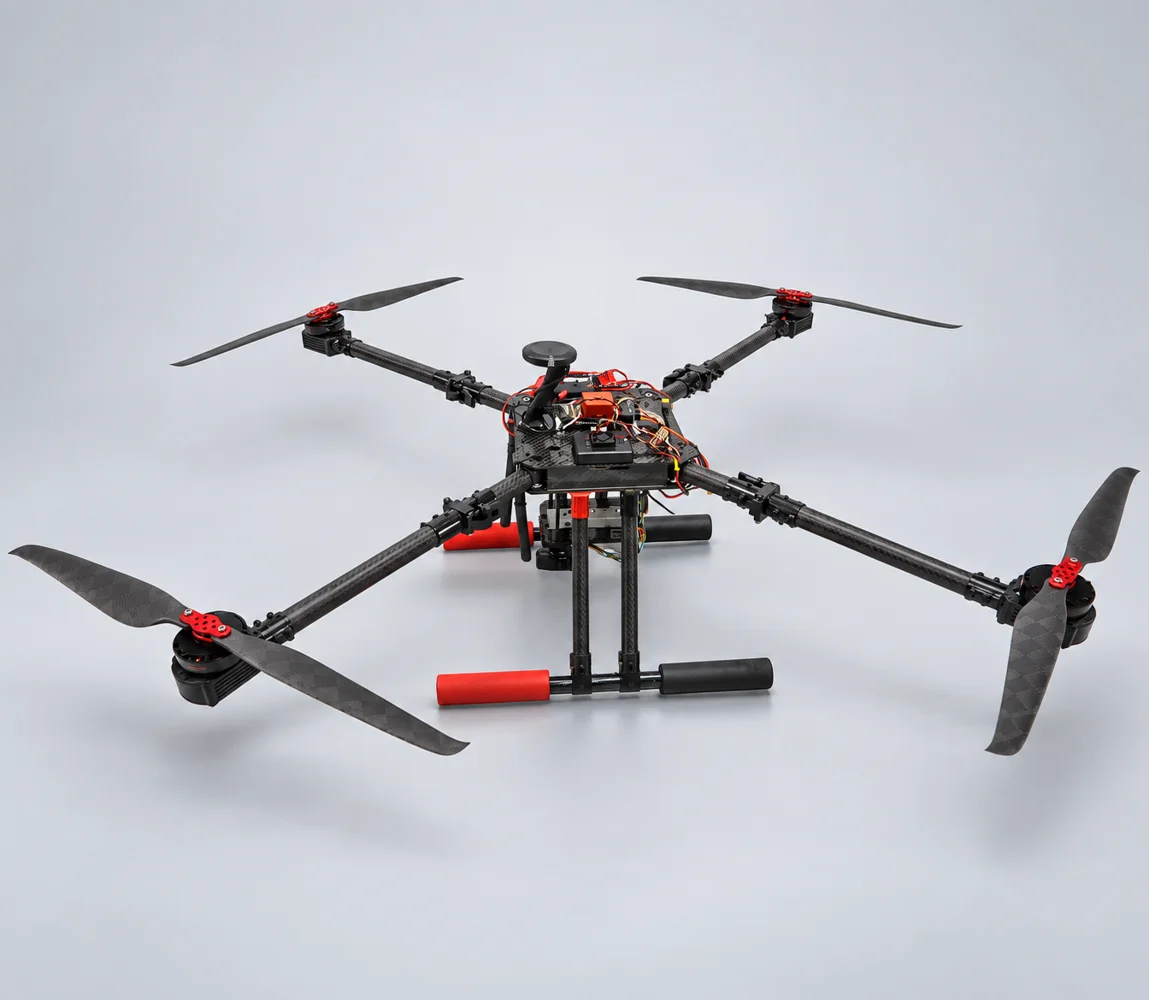
Illustrazione dimostrativa · originale sottoUni-D002 · piattaforma multirotore
Consulta struttura, alimentazione e controllo di volo per scegliere una piattaforma di osservazione. Specificare insieme camera e missione.
Esplora il sistemaDocumento fonte · originale inglese / cinese · 18
Il testo originale è riportato sotto nella lingua della fonte. Le introduzioni tradotte sono guide alla lettura, non traduzioni integrali. Confermare configurazione e condizioni operative del progetto.
Product Description - Portable and Multifunction
Features - Quick deployment task, Single-person operation, Measurement, Inspection and Monitoring
Application - Firefighter Surveillance UAV System
Fuselage Shape
Expanded size including blade: 105cm(L)x105cm(W)
Folded size excluding: 43cm(L)x43cm(W)
The fuselage is 4 shafts (using single shaft single propeller or coaxial double propeller)
Body
Weight: 4.3 kg (without battery); 7.3 kg (with battery)
Material: The main material is carbon fiber, joints or joints can be made of metal materials
Power source: Li Polymer Battery (12S48V, 16000 mAh)
Blades: Carbon fiber material, the specifications need to meet the flight performance requirements of each section
Motor: Brushless motor and direct drive
Flight Performance
Endurance (with 200 g gimbal): 50 min at 8 m/s; 42 min at 12 m/s
Max Take-Off Weight: 10 kg
Wind Resistant: wind force level 7
Flight Speed
Cruising speed of about 28 km/h
Flight Guidance and Image Transmission Distance
Flight guidance and image transmission distance 1 km / 10km (optional)
Lens: Supporting X6 Zoom, X10/X30 Zoom or Thermal Imaging (optional)
Support: Ground station / Communication relay
Provided a flat-panel directional antenna which can track and point to the position of the flying vehicle
OSD screen: display altitude, speed, satellite reception status, position coordinates, voltage status, direction and distance of Home point, flight time flight distance
Automatic Flight
Provided automatic take-off and landing, waypoint setting, low voltage / power failure can be automatic return and landing, the operator can switch manual / automatic flight.
The ground station displays the information of the aircraft body in the whole process, including:
Display the take-off point, return point, real-time position of flying, direction, and scheduled route with the map.
Display altitude, speed, heading, attitude (Roll and pitch), real-time voltage status with instrument graphics.
Other display items: Flight distance, straight-line distance from take-off point, and real-time position coordinates of flying.
Flying Accuracy
Flying with the GPS system, the positioning accuracy is within 1.5 m.
Flying with the RTK system, the positioning accuracy is within 30 cm.
Illustrazione dimostrativa · originale sottoConsulta struttura, alimentazione e controllo di volo per scegliere una piattaforma di osservazione. Specificare insieme camera e missione.
Esplora il sistemaUNI-CO TECH / Parliamo delle tue esigenze
Descrivi sito, attività, carico e vincoli operativi. La richiesta viene salvata nella piattaforma per revisione e assegnazione.
Contatti e allegati sono accessibili agli amministratori autorizzati per gestire la richiesta. Nessuna notifica automatica al fornitore. Per accesso o cancellazione, usare il contatto privacy della piattaforma.
Privacy e gestione richieste