Uni-Co TECH宇研共創科技

Source record · English / Chinese original · 18

Uni-D002

Original website text is reproduced below in its source language. Translated introductions are reading guides, not a full translation of the source. Confirm the configuration and operating conditions for your project.

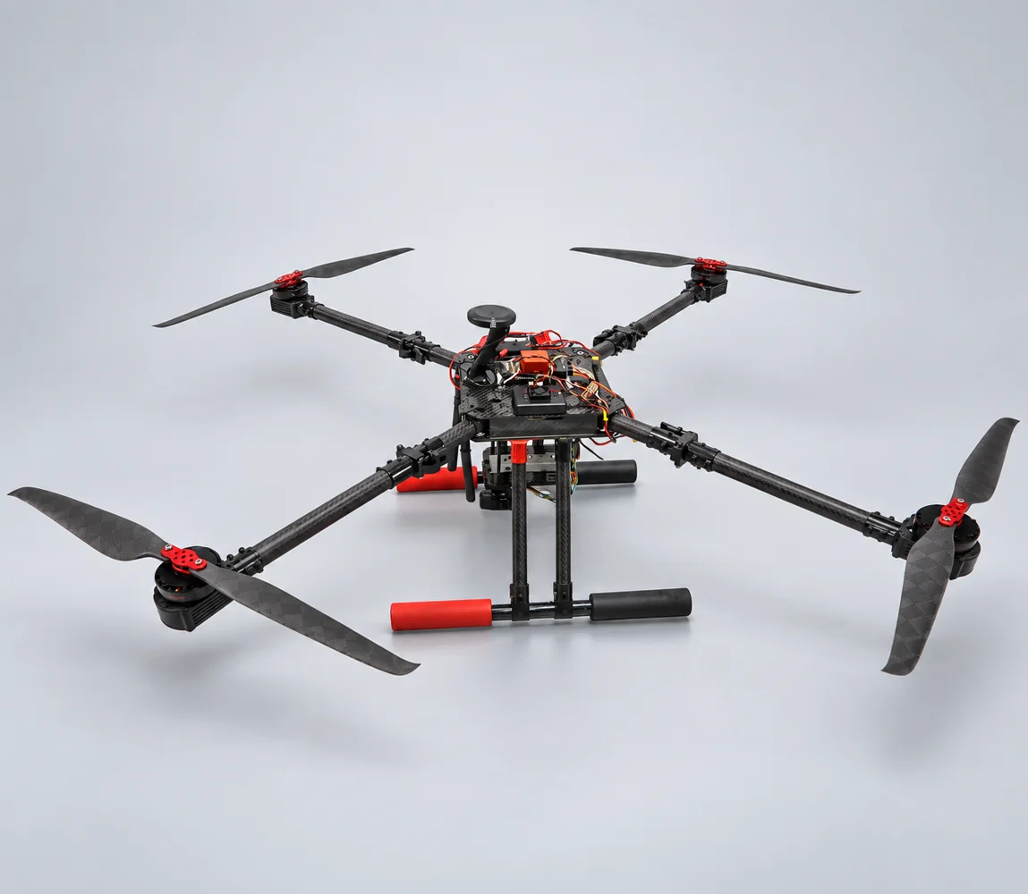
UNI-D002

Product Description - Portable and Multifunction


Features - Quick deployment task, Single-person operation, Measurement, Inspection and Monitoring


Application - Firefighter Surveillance UAV System


Fuselage Shape

  • Expanded size including blade: 105cm(L)x105cm(W)

  • Folded size excluding: 43cm(L)x43cm(W)

  • The fuselage is 4 shafts (using single shaft single propeller or coaxial double propeller)


Body

  • Weight: 4.3 kg (without battery); 7.3 kg (with battery)

  • Material: The main material is carbon fiber, joints or joints can be made of metal materials

  • Power source: Li Polymer Battery (12S48V, 16000 mAh)

  • Blades: Carbon fiber material, the specifications need to meet the flight performance requirements of each section

  • Motor: Brushless motor and direct drive


Flight Performance

  • Endurance (with 200 g gimbal): 50 min at 8 m/s; 42 min at 12 m/s

  • Max Take-Off Weight: 10 kg

  • Wind Resistant: wind force level 7


Flight Speed

  • Cruising speed of about 28 km/h


Flight Guidance and Image Transmission Distance

  • Flight guidance and image transmission distance 1 km / 10km (optional)

  • Lens: Supporting X6 Zoom, X10/X30 Zoom or Thermal Imaging (optional)

  • Support: Ground station / Communication relay

  • Provided a flat-panel directional antenna which can track and point to the position of the flying vehicle

  • OSD screen: display altitude, speed, satellite reception status, position coordinates, voltage status, direction and distance of Home point, flight time flight distance


Automatic Flight

  • Provided automatic take-off and landing, waypoint setting, low voltage / power failure can be automatic return and landing, the operator can switch manual / automatic flight.

  • The ground station displays the information of the aircraft body in the whole process, including:

      • Display the take-off point, return point, real-time  position of flying, direction, and scheduled route with the map.

      • Display altitude, speed, heading, attitude (Roll and  pitch), real-time voltage status with instrument graphics.

      • Other display items: Flight distance, straight-line  distance from take-off point, and real-time position coordinates of flying.


Flying Accuracy

  • Flying with the GPS system, the positioning accuracy is within 1.5 m.

  • Flying with the RTK system, the positioning accuracy is within 30 cm.


Original reference images

Continue your technical review

UNI-CO TECH / Discuss your requirements

Start with the work you need done.

Describe the site, task, payload and operating constraints. Your request is saved in the platform inbox for review and assignment.

Included with your requestUni-D002View original source

Your contact details and attachments are accessible to authorized platform administrators for handling this request. No supplier notification is sent automatically. For access or deletion requests, use the platform privacy contact.

Privacy & request handling